¶ What Is Risk MAP?
Federal Emergency Management Agency (FEMA) is responsible for mapping flood risk across the United States, as mandated by 44 CFR 64.3.
Risk Mapping, Assessment, and Planning (Risk MAP) is a FEMA program that provides communities with flood information and tools they can use to enhance their mitigation plans and take action to better protect themselves.
- The Risk MAP process creates Flood Insurance Rate Maps (FIRMs), sometimes called “flood maps."
- FIRMs show areas of high and moderate flood risk, depicted as different flood zones.
- FIRMs are used to inform building codes, land use regulations, and flood insurance rates.
- FIRMs are resource-intensive to produce and update.
- FIRMs are not available for every community.
- The Risk MAP program supports analysis, planning, and communications efforts, all of which aim to increase community resiliency.
¶ Examples of FIRMs
.jpg)
FIRM of Diamondville, WY
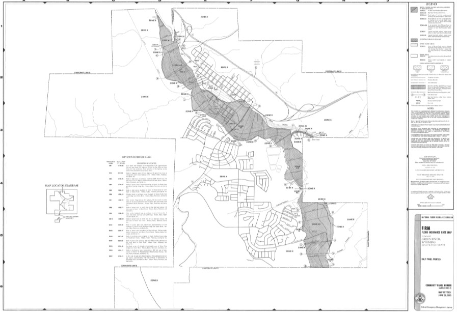
FIRM of Green River, WY
¶ What Is the Risk MAP Process?
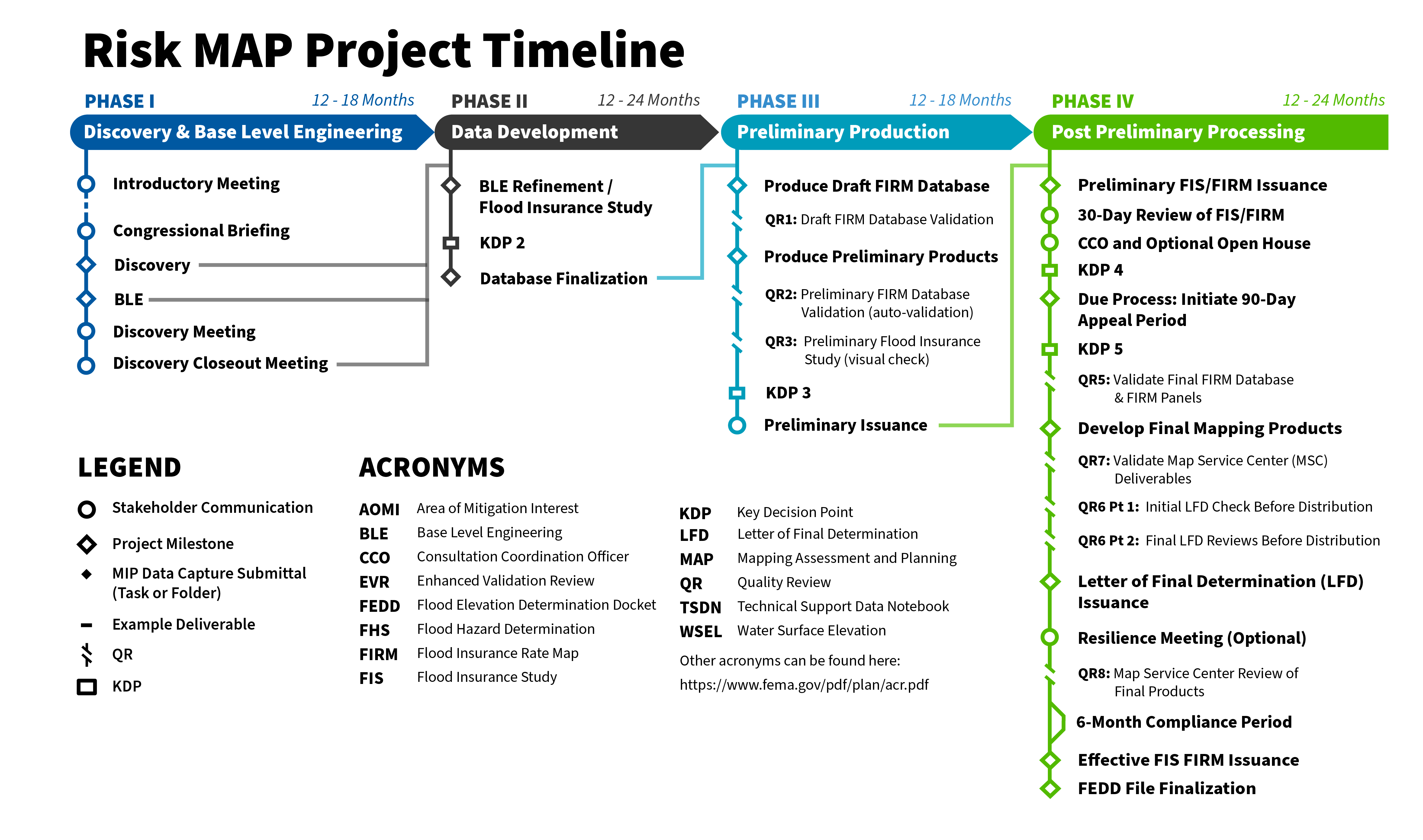
¶ Phase 1: Discovery and Base Level Engineering
You Are Here! Phase I is when the Risk MAP project team sets out to learn as much as it can about your community’s flood risk challenges and goals.
- Discovery: The Risk MAP project team reaches out to local officials and other stakeholders in order to collect relevant data and information and feedback on your community’s flood risk challenges and concerns. The team does all of this through research and interviews.
- Base Level Engineering (BLE): The Risk MAP project team then studies this information and produces flood hazard information--such as flood extents, depth, probability, and velocity--using ground elevation data and modeling software.
¶ Phase 2: Data Development
Phase 2: Data Development (also called Risk Analysis and Mapping) involves enhancing the BLE data collected in Phase 1: Discovery and BLE by incorporating additional refinement or detailed data into the models. Enhanced analysis may involve the determination and publication of Base Flood Elevations (BFEs), flood profiles, and the regulatory floodway.
Additionally, FEMA and its mapping partners prepare draft data, maps, and flood risk products, including the FIRM and Flood Insurance Study (FIS) report used for floodplain management and insurance requirements. Data, maps, and other flood risk products may also be used by local officials as non-regulatory data to support mitigation, community planning, and public outreach.
¶ Phase 3: Preliminary Production
FEMA prepares the preliminary flood maps, FIS, and other data developed in Phase 2: Data Development for official distribution to communities. The preliminary flood maps reflect FEMA's analysis of the community’s flood hazards and risk. They also include local information and knowledge shared by community members and public officials in Phase 1: Discovery and BLE. The changes reflected in the preliminary maps are listed in a preliminary Summary of Map Actions (SOMA).
¶ Phase 4: Post Preliminary Processing
Phase 4: Post Preliminary Processing is the last phase of the Risk MAP Process. In this phase, community officials and property owners are provided an opportunity to review the preliminary maps created in previous phases and submit written appeals and comments to FEMA for consideration.
While FEMA strives to include the most up-to-date information when identifying flood risk, community members may notice unaddressed inaccuracies or unaccounted-for changes. This phase allows community members to bring such things to light prior to FIRM finalization.
Once the FIRM has been adopted by the community and made effective, the community can base their floodplain ordinance and building and zoning codes on the new flood risk information finalized in the updated flood map.