¶ Your Community's Data
¶ Draft Discovery Report
The purpose of the Discovery Report is to summarize the Discovery Process for the Upper Green-Great Divide Watershed.
The report will summarize:
-
Watershed characteristics
-
Communities involved
-
Outreach conducted
-
Data analysis
-
Findings
-
Recommendations
Upper Green-Great Divide Discovery Report
The Upper Green-Great Divide Watershed Discovery Report is currently being drafted. It will be shared here as soon as possible.
¶ Draft Discovery Map
The Upper Green-Great Divide Watershed Discovery Map is currently being drafted. It will be shared here as soon as possible.
Upper Green-Great Divide Discovery Map
The Upper Green-Great Divide Watershed Discovery Map is currently in development. Contribute to its development by visiting the map site:
.png)
¶ 2D BLE Report
2D BLE Report
¶ How Was Your Community's BLE Data Created?
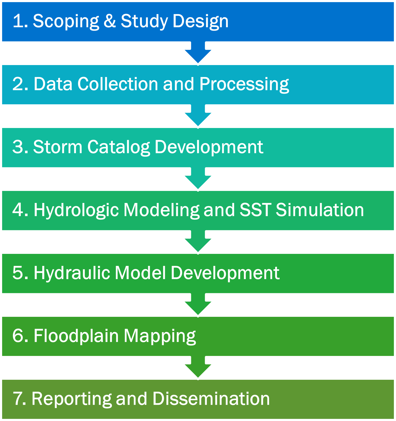
Watershed data collected and evaluated included FEMA effective studies; topography and land use; river networks, infrastructure, and sub-basins; and climate data. Using this data, the Project Team developed a tool to identify major historical storm events that reflected the study area's climate and supported science-based decision making.
From the wide range of storm events identified, the Project Team selected one representative storm per recurrence interval. This approach reduced the number of hydraulic model runs needed while still capturing the essential characteristics of the flood hazard. Representative storm event data was used to create rainfall runoff models that incorporated the study area's terrain, snowpack, temperature, and precipitation. The modeling results included flood frequency hydrographs and inflows for HEC-RAS hydraulic modeling and flood mapping.
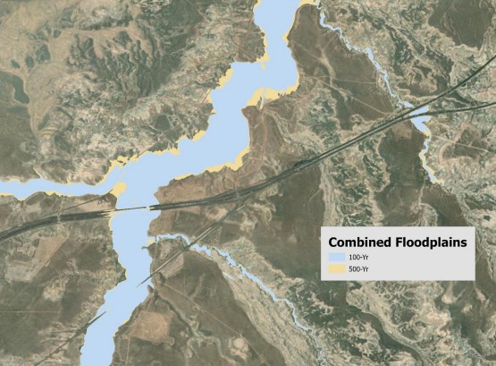
The Project Team used HEC-RAS and HEC-HMS software to develop 2D BLE hydraulic models. Most models were developed at BLE Option Level A, with refinement regions developed at Option Level C (more refined). Refinement regions were determined based on community NFIP participation and/or the presence of Zone AE classifications (high-risk flood zones). The BLE 10%, 4%, 2%, 1%, 1% plus, 1% minus, and 0.2% Annual Exceedance Probability (AEP) results were mapped to the model terrain.
The Project Team developed the following flood risk products with the BLE model data:
- Water surface elevation (WSEL) grids
- Depth grids
- Velocity grids
- Probability grids
FEMA's HAZUS software, using the BLE depth grids as input, calculated in dollars the Average Annualized Loss and the economic loss for the different AEP results at the Census block level.
BLE Modeling Approach
.png)
Final Refinement Regions Within the Study Area
¶ Who Produces BLE Data in Your Community?
FEMA leads the production of BLE data through a collaborative process involving contractors and state, local, regional, and/or tribal governments.
¶ Who Is Involved in This Process for the Upper Green-Great Divide Watershed?
FEMA Study Manager
Name: Christine Gaynes
Affiliation: FEMA Region 8
Email: christine.gaynes@fema.dhs.gov
FEMA Floodplain Management and Insurance Lead
Name: Peter Reinhardt
Affiliation: FEMA Region 8
Email: peter.reinhardt@fema.dhs.gov
FEMA Civil Engineer
Name: Zharif Mdazmi
Affiliation: FEMA Region 8
Email: ahmad.mdazmi@fema.dhs.gov
State Grants/Finance Section Chief
Name: Ashley Paulsrud
Affiliation: State of Wyoming
Contract Support: Discovery Lead
Name: Jerri Daniels
Affiliation: STARR II
Contract Support: Outreach Lead
Name: Katie Gronsky
Affiliation: STARR II
Contract Support: Outreach Support
Name: Natalie Kretzschmar
Affiliation: STARR II
Contract Support: BLE Production
Name: Curtis Smith
Affiliation: STARR II